A snippet into the past of Southern B.C. has revealed itself in the form of a City of Vancouver archival video.
The rather crisp and high-quality silent film showcases a rare look into the every day life of Southern B.C. residents during the mid to late 1930s.
Penticton historian Randy Manuel was blown away by the footage.
“It is fascinating,” said Manuel. “It is a piece of Okanagan and Kootenay history that just has not been seen. I was surprised to see this piece of film that one does not usually associate with this era. People would have had some private funding to have a camera. The clarity of the film is fantastic.”
The segment shown above is part of a series of three films called We Drivers that were produced for Vancouver’s Trimble Service Garage.
Shot on an eight-millimetre camera, the film showcases footage captured between 1936 and 1939 of the Arrow Lake and Penticton region.
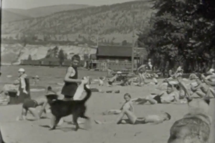
The 10-minute film contains footage of the sternwheeler S.S. Minto (0:30 mark), Nakusp, a steamboat, Arrow Park, Carrolls Landing, Burton, Penticton and Okanagan Lake as well as several towns and some beach scenes.
“Nakusp was remote country in those days and a lot of those little towns along the way, Arrow Park (2:45 mark), they are all under water now because of the big Hugh Keenleyside Dam that was built just upstream from Castlegar. All those towns shown are now 85 feet under water,” explained Manuel.
“This also shows very rare footage of sternwheelers operating and the shots of Penticton (5:00 mark) showing Penticton’s waterfront (6:10 mark). It also shows Penticton’s Main Street (7:00 mark) which I suspect is roughly 1937 footage as the original 1936 post office is in the background, as well as the The Three Gables Hotel.”
Manuel said the video revealed even more “neat” pieces of Penticton history.
“The other neat thing is the scene with the cows being milked (8:20 mark). That is Bird’s Dairy, which was located just about where the trade and convention centre is today.”
Manuel said that region was called the “meadows,” as anything west of Power Street was natural grasslands and marshes at the time.
“The Bird family had a dairy down that way. The last houses going west would have ended at the end of Wade Avenue, anything further west was marshy. If you had a year like this year where Okanagan Lake came up high, that would all naturally be under water,” said Manuel.
The video recently gained traction after it was . Their Facebook upload has already racked up more than 29,000 views and 460 shares.
carmen.weld@bpdigital.ca
Like us on and follow us on .


