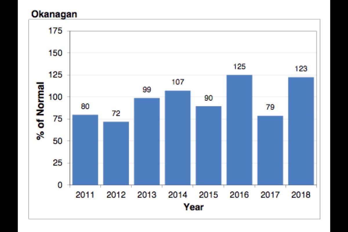
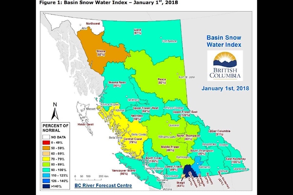
The Okanagan’s snowpack is sitting at 123 per cent of normal, according to the latest figures from the BC River Forecast Centre.
“Two key weather factors have been driving the seasonal snowpack development so far this year. First, cool and wet weather in November led to rapid development of the early-season snowpack,” according to the report released Jan. 1.
“By late-November snowpack at Automated Snow Weather Stations was 120 to 125 per cent of average across the province. The second key factor was the dominance of dry, arctic air through December.”
While temperatures were low, precipitation was limited, and there was very limited accumulation of snow throughout the majority of the month. Towards the end of December, westerly flow patterns brought back snow accumulation, including low elevation snow in southern BC.
Going forward there may be more snow on its way.
La Niña conditions are present in the equatorial Pacific Ocean, according to the forecast centre.
The Climate Prediction Centre at the U.S. National Weather Service/NOAA has issued a La Niña Advisory and is forecasting a high likelihood of La Niña persisting through this winter. Typically, La Niña is linked to cooler winters across British Columbia.
Snowpacks tend to be higher than normal; however, there has been a large range of variability in snowpack in B.C. during La Niña winters in the past.
A high snowpack was one of the factors that led to last spring’s flooding conditions in the area.
Seasonal forecasts from Environment and Climate Change Canada are indicating an increased likelihood of normal temperatures across western British Columbia and below normal temperatures in south-east B.C. Short-to-medium term forecasts are suggesting warmer temperatures through January. A period of wetter weather is forecast for the province through the middle of the month, and will likely lead to increased snow accumulation over higher terrain.


