The Okanagan Valley expects to get a bit of a respite form flooding fears this week, but it’s just the calm before another flood surge period descends upon us.
As the water levels of the valley lake system from Vernon to Osoyoos continue to rise, the weather forecast calls for northwesterly gusting winds up to 70 km/hr between 7 p.m. and midnight, while the thunderstorm warning has dissipated.
The pending relief from the 30+ hot temperatures on the valley bottom last weekend will raise the freezing level in the alpine region and slow down the snowpack melt.
“The temperatures change will increase the freezing level from 1,500 to 4,000 metres which is a drastic change to the freezing cycle for now,” said Matt McDonald, with Environment Canada.
That is one piece of good news shared by B.C. emergency planning and environment officials at a press conference held earlier this afternoon.
McDonald said expectations are for the warmer temperatures to return once the forecasted wind and rain have passed, and for those conditions to hold through the rest of May.
“So the good news is we appear to have dodged a bullet in the Southern Interior with the thunderstorm expectations. But with high winds, the soil moisture level is very high right now so the potential for damage with trees is a little bit higher with this front moving in, and the additional problem is causing wave action on the lakes.
“To put that 70 kilometre an hour wind forecast in perspective, the reference point is 60 kilometre winds when damage starts to occur on the shorelines.”
Dave Campbell, with the BC River Forecasting Centre, said Mission Creek remains a key tributary feeding into Okanagan Lake with a high level of snowpack still in its watershed alpine area, while to the south the rising Similkameen River is the wildcard for its water flows merging with the Okanagan River to potentially overwhelm the dam intake control for Osoyoos Lake.
“With the hot weather expected to return this week, it’s certainly a period to watch closely with another round of high flows starting at the end of this week and beginning of next week,” Campbell said.
Brian Symonds, water stewardship manager with the provincial ministry of forests, lands and natural resources, said handling the rising levels of the valley lake chain system that includes Wood, Kalamalka, Okanagan, Skaha, Vasieux and Osoyoos lakes remains a high priority issue that will likely carry on for the next two months.
“We have dam releases on many of those lakes and have the ability to make lake level adjustments, but what we are seeing right now is inflow levels exceeding what our ability is to let water out of the the larger lakes,” said Symonds.
Symonds said downstream impact from water releases is always a concern, considering for instance that Okanagan Lake is rising at three times the maximum release level.
“The equilibrium we want is to see a balance between what we can release and how much the lake is rising and we are not there yet,” Symonds said.
He said that will mean several weeks ahead of wind, rain and wave damage warnings, particularly in both Kalamalka and Okanagan lakes.
“Under these conditions, you start to see docks submerged, flooding of low lying shore lands, seepage of water into lakefront home crawlspaces, farming fields saturated and wildlife habitat areas damaged,” Symonds said.
Symonds said contrary to some concerns expressed about American interests on the U.S. side of the Osoyoos Lake dam water release taking precedence over Canadian water control interests, he said all lake flow release decisions are made out of Penticton.
“We are not bound by high or low flow limits related to American interests whatsoever, but at the same time we do realize that one-third of Osoyoos Lake is in the U.S. so there is a mutual interest incentive there.
“The constraints we face are more to do with the capacity of our structures to release water flow levels downstream and minimize any negative impact.”
As well, Symonds noted the potential wind and wave issues has led to some tension cable adjustments to the William Bennett Bridge.
“The bridge was designed to respond to lake levels outside of the norms, and those adjustments are being made. The integrity of the bridge is not a concern and it actually helps act as a breakwater in the middle of the lake against gusting winds,” he said.
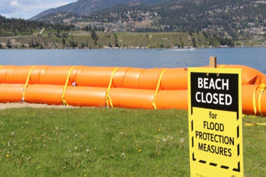
Chris Duffy, executive director of operations for Emergency Management BC, said the province has a flood protection arsenal of 1.7 million sandbags, 13 kms of Gabion diking, 14.5 kms of Tiger Dam tube diking, and a Gabion deployment team from Saskatchewan ready to assist bringing with them a further three kms of the wire-mesh diking system.
“We are constant contact with First Nations and communities in affected areas but emergency preparedness is a shared responsibility. There is only so much we can do,” Duffy said.
“We need everyone in potential flood areas to take precautions where they can to protect their property and themselves. Have an emergency kit ready to go and be prepared to move quickly if an evacuation order is given.
“Everyone pulling their weight is a shared responsibility to help meet our priority, which is to keep the public safe. We need to maintain vigilance, plan for the worst and hope for the best.”


